What the ground scans show
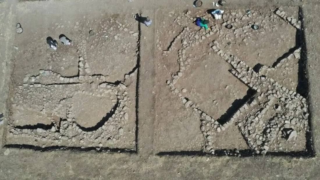
Long before a trench is opened, archaeologists can 'see' into a mound with geophysical survey — magnetic and ground-radar readings that pick out buried walls and pits without moving any earth. At Göbekli Tepe this work was done in campaigns in 2003, 2006, 2007 and 2012, and it changed the scale of the site in everyone's mind.
The 2003 field report by Klaus Schmidt, who led the excavation until his death in 2014, put it plainly: more than ten large enclosures showed up in the geomagnetic map, with more expected. Counting the four then under excavation, the survey suggested a minimum of around twenty enclosures across the whole tell — and, at roughly a dozen pillars each, on the order of 200 T-shaped pillars still to be accounted for.
Later surveys confirmed the key point: the great circular buildings are not confined to one corner of the mound but spread across it.
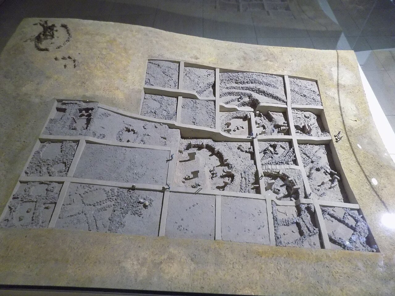
Cobija, Göbeklitepe kazı alanı maketi, CC BY-SA 4.0, via Wikimedia Commons.
How little has been dug
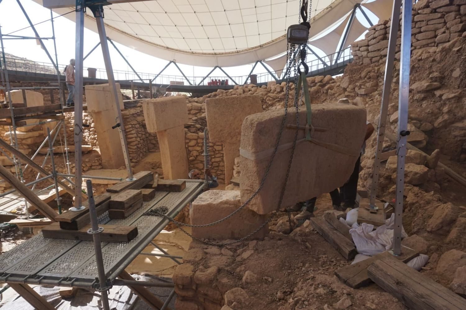
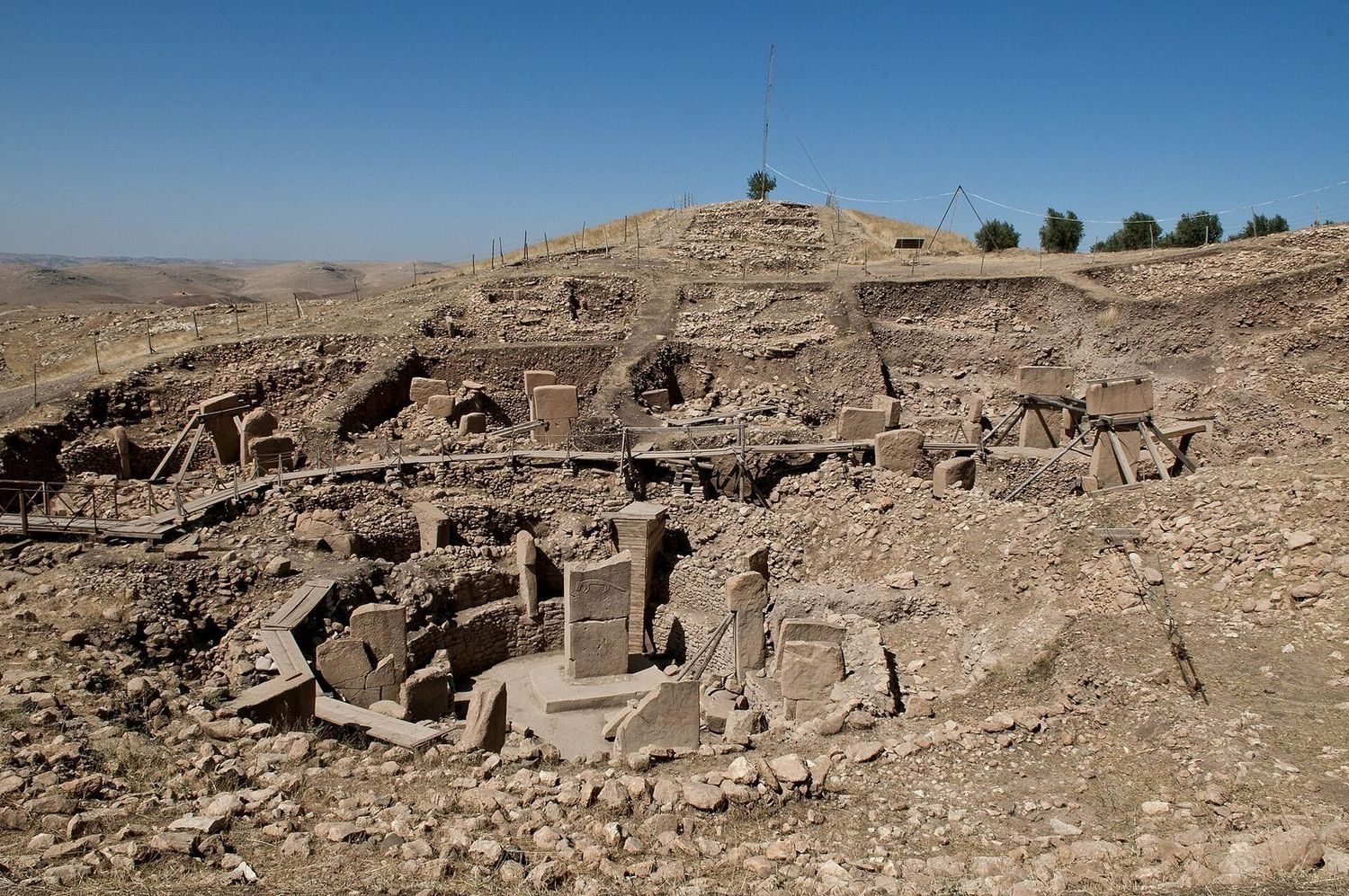
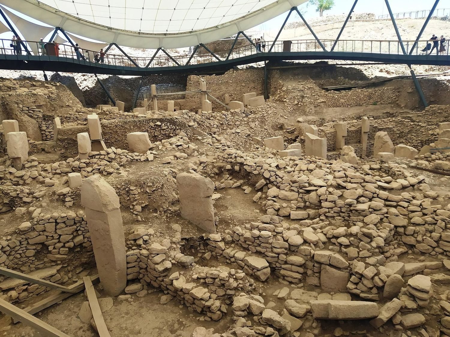
Against that buried total, what visitors see is a small sample. Only a handful of the enclosures have been fully excavated, and reporting on the site commonly describes around 10 percent of Göbekli Tepe as dug so far. On the same reckoning, clearing the whole mound at the current pace would take something like 150 years.
In 2026 the excavation added a further reminder of how much is left, with geophysical work near the monumental buildings again detecting large buried structures on ground that has never been opened. (What kind of buildings those were — including whether some were lived in — is a separate question, handled on its own page.)
Why it matters
It is easy to treat Göbekli Tepe as a finished monument. It is closer to the opposite: a site where the famous enclosures are the first pages of a much longer book, most of it still sealed underground.
That is also why patience and conservation matter here. Much of the mound is being deliberately left in place — protected, mapped, and waiting for methods better than today's — rather than dug out all at once.
Reading a mound before you dig it
Geophysical survey is the reason anyone can talk about Göbekli Tepe's true size at all. Magnetic readings and ground-penetrating radar register the buried walls, pits and stone of a mound as faint patterns at the surface, so a team can sketch what lies underground without moving any earth. At Göbekli Tepe this work ran in campaigns across 2003, 2006, 2007 and 2012, and each pass sharpened the same conclusion.
The picture it produced was decisive: the great circular buildings are not clustered in one corner of the hill but scattered across it. Counting the four enclosures then under excavation alongside the ten-plus that showed in the magnetic map, Klaus Schmidt — who led the dig until his death in 2014 — reckoned a minimum of around twenty across the whole tell. At roughly a dozen pillars apiece, that implies something on the order of two hundred T-shaped pillars still in the ground.
A monument that is mostly still a promise
Set the survey total against what has actually been opened and the scale of the task becomes clear. Only a handful of enclosures have been fully excavated, and the site is commonly described as roughly ten percent dug — which is why the same reporting reckons that clearing the whole mound at today's pace could take on the order of 150 years.
That is not a failure of effort so much as a deliberate choice. Much of the mound is being left sealed on purpose: protected, mapped and kept in reserve for methods better than today's, rather than stripped out all at once. The famous enclosures, on this reading, are the first pages of a much longer book — and in 2026 fresh geophysical work near the monuments again picked up large buried structures on ground that has never been opened, a reminder of how much of that book is still closed.
What is uncertain
The enclosure count is an estimate from geophysics, not a dig tally: survey readings show buried structures, but only excavation confirms what they are and how old. The 'around 20 enclosures' figure comes from the early-2000s magnetic maps; the '10 percent' and '150 years' framings are widely reported estimates, not precise measurements.
The ages of the unexcavated buildings are unknown. They resemble the older circular enclosures in the survey images, but that is an educated guess until a trowel reaches them.
Common questions
How much of Göbekli Tepe has been excavated? Reporting on the site commonly describes around 10 percent as dug so far. On the same reckoning, clearing the whole mound at the current pace would take something like 150 years.
How many enclosures are buried at Göbekli Tepe? Geophysical survey suggests a minimum of around twenty great enclosures across the tell — and, at roughly a dozen pillars each, on the order of 200 T-shaped pillars still to be accounted for.
Are the buried buildings the same age as the excavated ones? That is unknown. They resemble the older circular enclosures in the survey images, but that stays an educated guess until excavation reaches them.
Key takeaways
- Geophysics lets archaeologists 'see' buried walls before digging; at Göbekli Tepe it showed the enclosures spread across the whole mound, not one corner.
- Klaus Schmidt's 2003 report mapped more than ten enclosures, implying a minimum of around twenty and roughly 200 T-pillars still buried.
- Only about 10 percent of the site has been dug; at the current pace clearing it all could take something like 150 years.
- Much of the mound is being deliberately left in place — protected and mapped for better future methods.
Sources
- DAI Tepe Telegrams — Looking beneath the surface: geophysical surveys at Göbekli Tepe
- Archaeology Magazine — Dwellings Detected Near Monuments at Göbekli Tepe (20 August 2026)
- The Jerusalem Post — Excavations at Göbekli Tepe continue to yield findings (26 February 2025)
This article is written from the primary literature and excavators' reports cited above. Interpretations are attributed; uncertainties are stated in the text.